

The surface and canopy fuels products are representative of the particular type of disturbance experienced by herbaceous, shrub and tree lifeforms along with regrowth to the year indicated (usually the year released).
LANDFIRE (LF) fuel products describe the composition and characteristics of surface and canopy fuel and:
- provide consistent fuel information to support fire planning, analysis, and budgeting to evaluate fire management alternatives
- supplement strategic and tactical planning for fire operations
Fuel Related Data
Landscape GeoTIFF
The Landscape GeoTIFF (landscape) file, a multi-band raster format, is commonly used by wildland fire behavior and fire effects models.
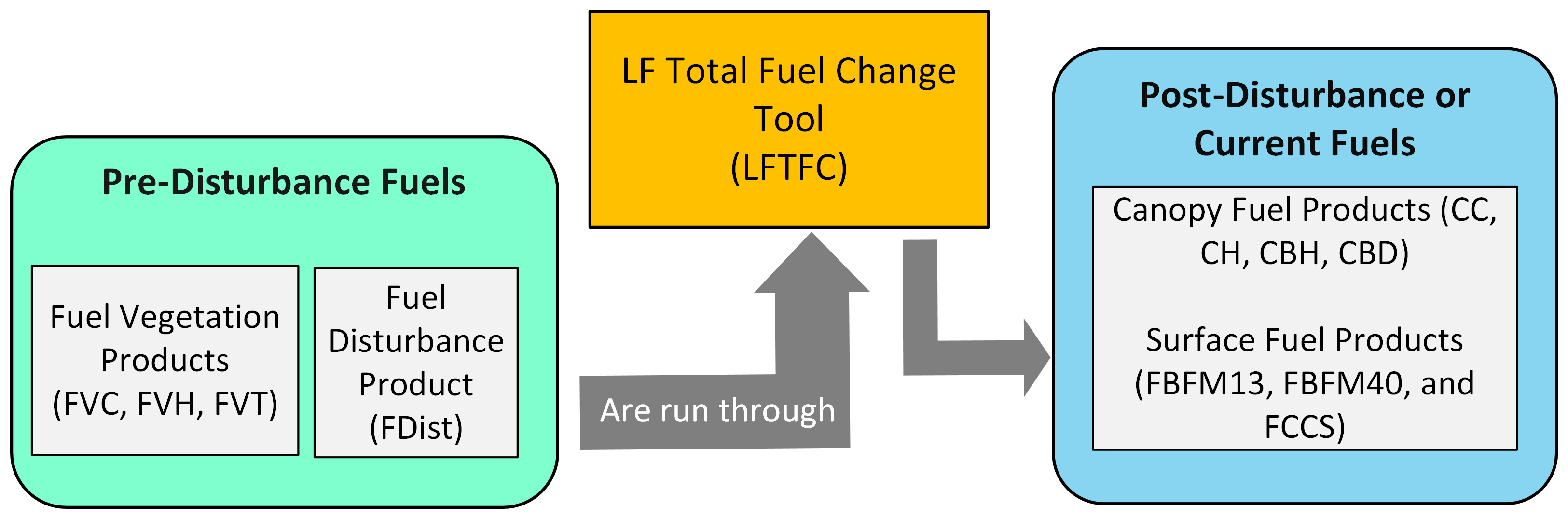
Fuel Rulesets Database and LANDFIRE Total Fuel Change Tool
The Fuel Rulesets Database displays LF fuel rules by Existing Vegetation Type (EVT), non-disturbance or disturbance type, and LF map zone. The LFTFC facilitates editing LF rule sets to create customized surface and canopy fuel layers for local applications.
Operational Roads
The Operational Roads layer helps support operations and firefighting efforts