

 Latest News
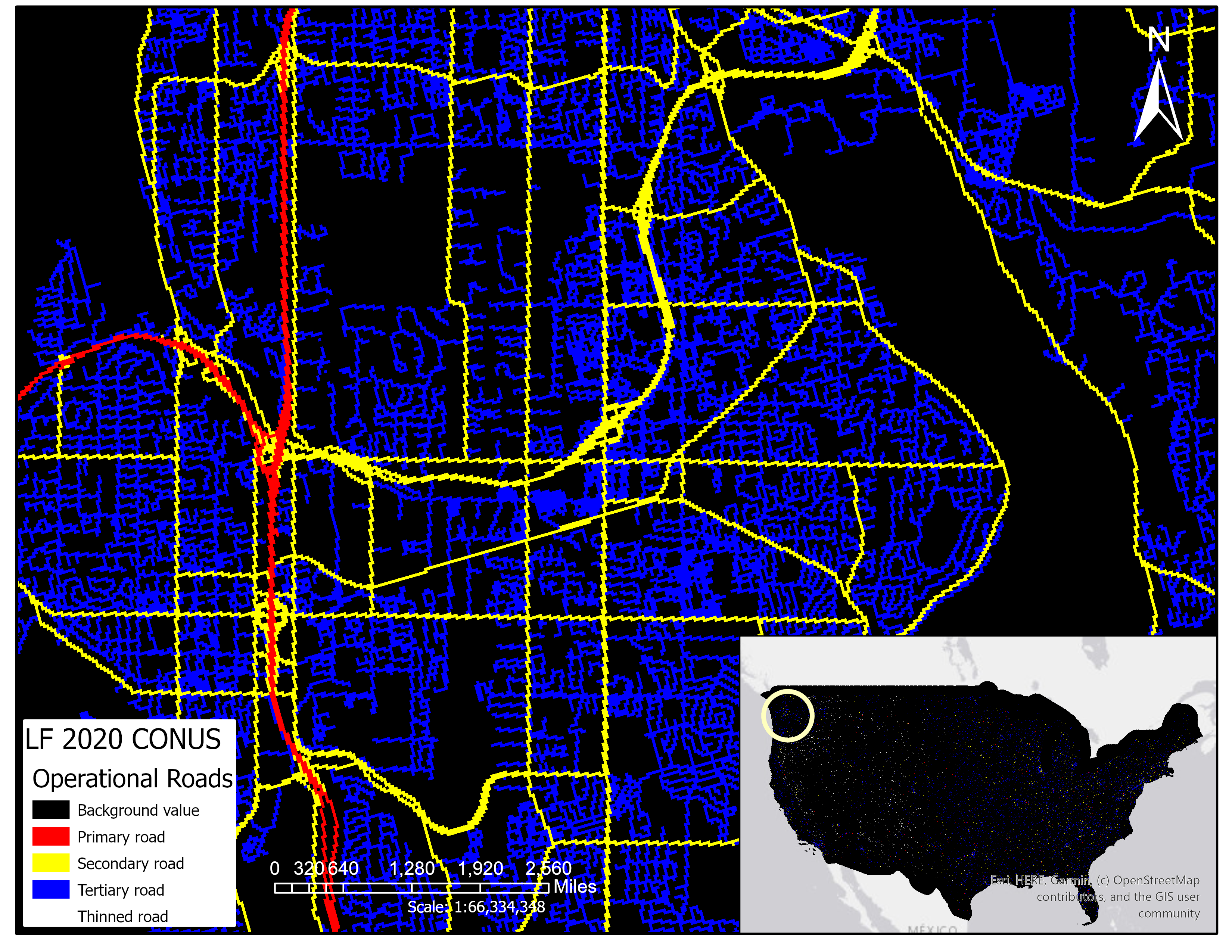
The LANDFIRE Operational Roads product was introduced in LF 2020 and is intended to support fire operations. In the Operational Roads product, all known roads are represented. This product includes all pixels from the four roads classes within theNational Land Cover Database (NLCD) 2019 Developed Imperviousness Descriptor product for the Conterminous United States (CONUS) including all pixels of primary (Value 20), secondary (Value 21), tertiary (Value 22), and thinned (Value 23) roads. The NLCD 2019 roads layer incorporates other major federal road layers such as commercial roads data.
The Operational Roads product addresses the need for a roads layer that provides comprehensive coverage of existing roads of all sizes. It can be used with other spatial data layers to assist users with decisions on access and egress for firefighting equipment, control points for fighting fires, or potential evacuation routes.
How is the Operational Roads product different from the Developed-Roads class within other products?
Unlike the Operational Roads product, the developed-roads class represented in the LANDFIRE vegetation (Existing Vegetation Type (EVT), Cover (EVC), and Height (EVH)) and fuel products (e.g. Canopy Cover (CC) and Height (CH)) is trumped by overlapping vegetation. For example, if there is both vegetation and a road present in a pixel during the creation of the EVT product then the vegetation takes priority, and the pixel is assigned a specific vegetation type class, rather than a developed-roads class.
Additionally, the smallest NLCD roads class, thinned roads (Value 23), was not used in the developed-roads class within vegetation and fuels products.
A particular pixel's vegetation designation also gets used in assigning fuels. This can result in "broken roads" but is helpful for understanding fuels continuity when modeling fire behavior. The Operational Roads layer contains no "broken roads" and is not focused on fuel continuity.
Other Useful Information
For the Operational Roads product, value 255 indicates NoData.
Operational Roads in Alaska involved combining NLCD 2016 Urban Descriptor for Alaska and a commercially available roads dataset by buffering the roads by 15m, rasterizing them, and adding them to the NLCD roads. Where NLCD and the commercial data overlapped, NLCD was used. Commercial data roads classes were translated to NLCD primary, secondary, tertiary, and thinned roads based on the descriptions, whether it was paved, and speed categories.
Operational Roads in Hawaii, Puerto Rico, American Samoa, and Guam were derived from the 2017 US Census Bureau TIGER lines (US Census Bureau, 2017) and include pixels within 15m of the road lines. The lines were buffered by 15m and then converted to raster using the "recode" field to designate the new pixel values.
Product availability
Attribute Data Dictionary 
Comma separated value (CSV) files can be found in the LF Library.
Download DataMetadata:
