

 Latest News
Overview
LANDFIRE (LF), Landscape Fire and Resource Management Planning Tools, is a shared program between the wildland fire management programs of the U.S. Department of Agriculture Forest Service and U.S. Department of the Interior, providing landscape scale geo-spatial products to support cross-boundary planning, management, and operations.
What We Do
This multi-partner program produces consistent, comprehensive, geospatial data and databases that describe vegetation, wildland fuel, and fire regimes across the United States and insular areas. Use the LF Definitions Quality and Standards Report to learn how LF creates the data.
Our Vision
LF is a cornerstone of a fully integrated national data information framework developing and improving vegetation and fuels data products based on the best available authoritative data and science in an all lands landscape conservation approach based on inter-agency/inter-organizational collaboration and cooperation. LF is acknowledged for management excellence and effective mission delivery.
Our Mission
LF's mission is to provide agency leaders and managers with a common "all-lands" data set of vegetation and wildland fire/fuels information for strategic fire and resource management planning and analysis.
What You Will Find
This website provides data and links to LF data, articles/reports, data descriptions, databases, LF videos and tutorials, images/maps, websites, and decision making/informational tools. These resources are useful for practitioners in the fields of fire and natural resource management, vegetation, habitat, carbon/climate, research and science, as well as industry/private sector users and teachers. Use our LANDFIRE Data Dictionary to help locate LF information.
How Data Products and Information may be used
LF data products provide data for landscape assessment, analysis, and management. Data and information serve as important data sets in decision support with efforts such as identification of areas with similar characteristics, prioritization exercises, modeling capacity and potential, and improving collaboration between landowners with common data sets and analytics.

Background
The LF Program evolved from increased concern about the number, severity, and size of wildland fires.
In 2000, the President directed the Secretaries of Agriculture and the Interior to recommend how best to respond to severe wildland fires, reduce the impacts of fire on rural communities, and ensure sufficient firefighting capacity in the future. As a result, Congress directed development of the National Fire Plan, which precipitated LF, along with the creation of a National Cohesive Wildland Fire Management Strategy (Cohesive Strategy) addressing responses to wildfire, restoring and maintaining resilient landscapes, creating fire-adapted communities all based on a scientific foundation. LF is a shared program between the U.S. Department of Agriculture Forest Service and U.S. Department of the Interior's wildland fire management bureaus under the direction of the Wildland Fire Leadership Council (WFLC). LF produces a comprehensive, consistent, scientifically based suite of spatial layers and databases for the entire United States and territories.
In 2001, the General Accounting Office (GAO) reported,
"Federal land management agencies do not have adequate data for making informed decisions and measuring the agencies' progress in reducing fuels."
In 2002, GAO reported,
"Data are not available to better prioritize communities and projects for funding" and "On the basis of our review, LANDFIRE is the only proposed research project so far that appears capable of producing consistent national inventory data for improving the prioritization of fuel projects and communities." (GAO-02-259)
LF started with a prototype in 2002 and was officially chartered in 2004 by WFLC. LF marked its 10th year in 2014 and its 15th year in 2019. View the LF informational video.

Awards and Recognitions

Learn more about the LF Program's accomplishments in innovations integrating data across all lands of the U.S.
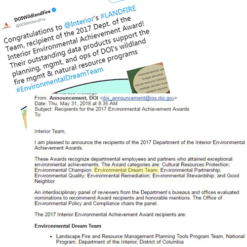
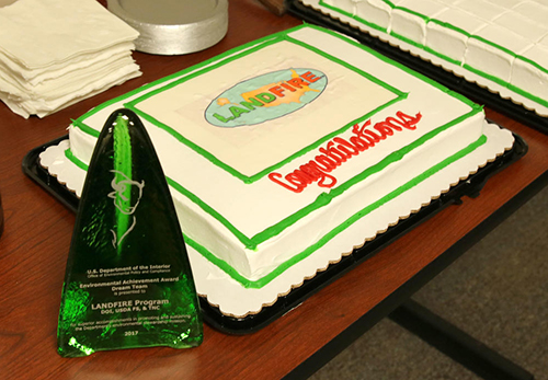
LF takes pride in producing consistent, comprehensive, and innovative biological and ecological data. LF is honored for its recognition of its success as it develops and produces cutting edge spatial data at a national extent.
Team Awards

 Watch a short, informal award ceremony held at The Nature Conservancy's Worldwide Office in Arlington, VA, on September 10, 2018.
Individual Awards
Program Planning
Program Update and Closeout Report:
Operations and Maintenance
The LF Program provides operations and maintenance activities, ensuring LF data products remain useful and accessible to the user community. In 2008, the Business Case and Technical Plan addressed:
In 2010 a General Management Evaluation (GME) and Futures Forum were conducted as the project transitioned to an Operations and Maintenance program. These efforts were initiated to improve the effectiveness of future program efforts. LF products are kept current and useful by incorporating user contributed disturbance, treatments, and feedback and remotely sensed disturbances in each version.
Communications

Factsheets
LF Briefs
Associated Websites
LF YouTube
Webinars & Presentations
LF Outreach
LF "In the Spotlight"
LF PodCasts
LF Team
Logos
LF Business and Technical Leads
| Henry Bastian, DOI Business Lead | Inga La Puma, USFS LF Program Lead | Marcine Hyser, TSSC Task Manager |
| James Menakis, USFS Business Lead | Jim Smith, TNC LF Project Lead | Daryn Dockter, TSSC Technical Lead |
| Jon Dewitz, Acting USGS Project Manager | Tobin Smail, USFS Technical Lead |
Partners
LF is a multi-organizational program whose work is completed with the cooperation of several groups working together. The strength of the program is built upon the partnerships over the course of the last decade. Learn more about what this entails.