| Fuel Product Alerts |
posted 2021-11-01 | [Fuel] Updates to the LANDFIRE (LF) 2016 Remap Fuel Characteristic Classification System Fuelbeds (FCCS) 2020 capable fuels product | Updates to the LANDFIRE (LF) 2016 Remap Fuel Characteristic Classification System Fuelbeds (FCCS) 2020 capable fuels product:
Reason for the alert: An LF 2016 Remap FCCS fuel bed linked was incorrectly linked to a vegetation type in 20 map zones located in the South Central, Southeast, and Northeast GeoAreas.
Updated product(s) or information: LF 2016 Remap (LF 2.0.0) FCCS 2020 capable fuels products were updated on 11/01/2021. The issue is limited to 20 map zones in the South Central, Southeast, and Northeast GeoAreas of CONUS, but mosaics were also impacted.
Problem or issue description: A fuel bed within LF 2016 Remap (LF 2.0.0) 2020 capable fuels products was incorrectly linked to a vegetation type in twenty map zones (SC z32, z35, z36; SE z37, z44, z45, z46, z48, z54, z55, z56, z58, z98, z99, and NE z47, z49, z57, z59, z60, z61) located in the South Central, Southeast; and Northeast GeoAreas. The misprint in the look-up table (LUT) that associates the fuel bed to the vegetation type, showed that FCCS fuel bed 538 Pacific Limestone Forest was linked to Existing Vegetation Type (EVT)/Fuel Vegetation Type (FVT) 2575 Southeastern Ruderal Grassland and Shrubland. The correct association should be FCCS fuel bed 519 Southern Ruderal Grassland to EVT/FVT 2575 Southeastern Ruderal Grassland and Shrubland. The FCCS Master Database will also be updated to reflect this change.
Users are advised to download the updated versions of the LF 2016 Remap FCCS 2020 capable fuels products and FCCS Master Database and delete any local copies that were downloaded prior to 11/01/2021. We regret any inconvenience this may cause.
| |
|
| posted 2021-09-29 | [Fuel] Updates to the LANDFIRE (LF) 2016 Remap CONUS Fuel Characteristic Classification Fueldbeds product |
Reason for the alert: LF 2016 Remap Fuel Characteristic Classification System Fuelbeds (FCCS) was updated.
Updated product(s) or information: LF Remap (LF 2.0.0) FCCS was updated on 09/29/2021. CONUS mosaics and data downloads were impacted.
Problem or issue description: LF Remap FCCS was updated to correct an error previously present in the DBF that caused some values in the FCCS id column to be 0, causing a display issue for those values.
Users are advised to delete any local copies of the FCCS product prior to September 29, 2021, and download the current version. We regret any inconvenience this may cause. | |
|
| posted 2021-03-18 | [Fuel] Updates to the LANDFIRE (LF) 2016 Remap Forest Canopy 2020 capable fuel products |
Reason for the alert: LF 2016 Remap (LF Remap) forest canopy products for 2020 capable fuels including Canopy Base Height (CBH), Canopy Bulk Density (CBD), Canopy Height (CH), and Canopy Cover (CC) were updated for the North Central (NC) GeoArea and within the Conterminous U.S. (CONUS) mosaics.
Updated product(s) or information: LF 2016 Remap (LF 2.0.0) 2020 capable fuels canopy products (CBD, CBH, CH, and CC) were updated on 03/18/2021. The issue is limited to the NC GeoArea of CONUS, but mosaics were also impacted.
Problem or issue description: LF Remap forest canopy products were updated in the NC GeoArea and mosaics, to correct an error with 2020 capable fuels canopy cover. Previously, in error there was a value of 1 for CC that had no defining information. This impacted all other LF Remap 2020 NC forest canopy products and the mosaics. Users are advised to download the updated versions of the 2020 capable fuels forest canopy products and delete any local copies of these products that were downloaded prior to 03/18/2021. We regret any inconvenience this may cause. | |
|
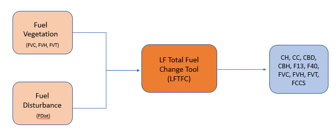
| posted 2020-01-24 | [Fuel] Updates to LANDFIRE (LF) Total Fuel Change (LFTFC) Tool Database |
Updates to LANDFIRE (LF) Total Fuel Change (LFTFC) Tool Database
Reason for alert: Update of LFTFC Tool database
Updated product(s) or information: An error was discovered in the .318 version of the LFTFC default database that was causing errors in the LFTFC and projects. A fix has been administered and the updated database, version .319, is now available.
Problem or issue description: Version .318 had a mistake in the naming of the tables. Users are advised to download the updated version of the LFTFC Tool and delete local copies of the tool that were downloaded prior to January 17, 2020. We regret any inconvenience this may cause.
Note: If you want to continue to use the previously created project, then the names need to be corrected in the database in the project you are using.
To make the correction, look in "Data_MU_Name" table...these names should be exactly the same as the name of the tables in the table of contents before the "_cmb" and "_rulesets." For example: "z01_NW19_RM" in the "Data_MU_Name" table should be the same as the name before the "_CMB" and the "_Rulesets" table name.
| |
|
| posted 2019-06-25 | [Fuel|Disturbance] Updates to LF Remap Fuel products for Northwest and Southwest GeoAreas... |
Updates to LANDFIRE (LF) Remap Fuel products for Northwest and Southwest GeoAreas
Reason for alert: Update of LF Remap fuel products for the Northwest (NW) and Southwest (SW) GeoAreas
Updated product (s) or information: Four LF Remap (LF_2.0.0) products for the NW and SW GeoAreas were updated 6/25/2019 with corrected input layers. The updated products are:
Fuel Vegetation Type (FVT)
Fuel Vegetation Cover (FVC)
Fuel Vegetation Height (FVH)
Fuel Disturbance (FDist)
Problem or issue description: Users are advised to download the updated versions of the four fuel products listed above and delete local copies of these products that were downloaded prior to Jun 25, 2019. We regret any inconvenience this may cause.
| |
|
| posted 2019-06-17 | [Fuel|Disturbance] Change to LF Remap fuels for disturbed areas represents effective year 2019... |
Change to LF Remap fuels for disturbed areas represents effective year 2019.
Reason for alert: Users of existing LANDFIRE (LF) fuel products need to be aware of a change in the products being released as part of Remap.
LF version(s): LF Remap (LF 2.0.0)
Updated product(s) or information: Areas mapped as disturbed by LF have been adjusted to account for vegetation conditions relative to Time Since Disturbance (TSD) for the 2019 effective year (accounting for disturbances between 2009 - 2016). This adjustment has been made to the following LF Remap products:
13 Anderson Fire Behavior Fuel Models (FBFM13)
40 Scott and Burgan Fire Behavior Fuel Models (FBFM40)
Forest Canopy Cover (CC)
Forest Canopy Height (CH)
Forest Canopy Bulk Density (CBD)
Forest Canopy Base Height (CBH)
Fuel Vegetation Type (FVT)
Fuel Vegetation Cover (FVC)
Fuel Vegetation Height (FVH)
Fuel Disturbance (FDist)
Historical Disturbance (HDist)
Problem or issue description: The significant refinement for the LF Remap products mentioned above, is that they represent "capable" fuels, meaning the TSD assignments have been calculated using an effective year. For example, LF Remap fuels are now assigned for the 2019 effective year. The new process considers all incorporated disturbances in LF Remap and provides an adjustment factor to account for the TSD, making the data "capable" of representing an effective year. These capable data account for increase or decrease in fuel attributes in disturbed areas to the effective year (2019 in this case).
Given that LF Remap is circa 2016 data, it is important to note that no new disturbances are added for 2017 through 2018. Although these new disturbance data are not available yet, they are being cataloged for future use in an Update. Disturbances older than 10 years in 2019 follow the existing LF protocol for removal from Fuel Disturbance and are represented by more recent non-disturbed LF Remap vegetation. For areas that have not been disturbed, fuel is based on LF Remap vegetation, which is the newest fuel vegetation available.
The objective for this change was to improve, clarify, and simplify fuel transitions and Fuel attribute change following disturbances. By synchronizing TSDs, users may not need to do much, if any adjustments, to the vegetation and fuel conditions to represent contemporary conditions. In addition, these refinements will improve performance of fire behavior modeling when using the data operationally. Starting with the Southwest GeoArea release (which includes Northwest GeoArea fuel products), LF Remap fuels will be delivered as capable fuels for the 2019 effective year.
The LF team stands ready to assist with questions and concerns regarding LF products. Contact us at the LF helpdesk.
| |
|
| posted 2015-06-02 | [Fuel] Updates to LANDFIRE 2012 Alaska canopy layers ...
|
Subject: Updates to LANDFIRE 2012 Alaska canopy layers
Date: June 2, 2015
Reason for alert: An issue occurred in the canopy values for Boreal Floodplain Existing Vegetation Type (EVT) 2763.
LANDFIRE version(s): LANDFIRE 2012 (1.3.0)
Updated product(s) or information: The following LANDFIRE 2012 (LF 1.3.0) Alaska canopy layers were updated:
Canopy Bulk Density (CBD)
Canopy Base Height (CBH)
Canopy Cover (CC)
Canopy Height (CH)
Problem or issue description: When the canopy values for Boreal Floodplain Existing Vegetation Type (EVT) 2763 were calibrated they were two EVT's - 2014 and 2015 - and both had a canopy value of 0. However, these two EVT's were aggregated into one - EVT 2763 - with three lifeforms and the 0 canopy value was retained for LF National through LF 2012. Tree pixels with an EVC were not assigned CC because of the 0 canopy value. This issue has been corrected in LF 2012 for CC, CH, CBH, and CBD.
Advice to users: Users are advised to delete local copies of these layers downloaded prior to June 1, 2015 and download the updated versions. We regret any inconvenience this may cause. Please contact the LANDFIRE Help Desk with any questions.
| |
|
| posted 2015-04-09 | [Vegetation|Fuel|Disturbance]
LANDFIRE 2012 (LF 1.3.0) layers for the Northwest (NW) GeoArea were
updated... |
LANDFIRE 2012 (LF_1.3.0) layers for the
Northwest (NW) GeoArea were updated 4/9/2015 with corrected input layers. Updated layers include:
Existing Vegetation Type (EVT)
Existing Vegetation Height (EVH)
Existing Vegetation Cover (EVC)
Canopy Bulk Density (CBD)
Canopy Base Height (CBH)
Canopy Cover (CC)
Canopy Height (CH)
Fire Behavior Fuel Models 13/40 (FBFM13/40)
Disturbance 2012 (D2012)
Fuel Disturbance 2012 (FDIST2012)
Vegetation Disturbance 2012 (VDIST2012)
Vegetation Transition Magnitude (VTM2012)
Users are advised to download the updated versions and delete local copies of these layers that were downloaded prior to
April 8, 2015. We regret any inconvenience this may cause.
| |
|
| posted 2012-06-05 | LANDFIRE 2008 (LF 1.1.0) Fire
Behavior Fuel Models 40 (FBFM40) for Hawaii, zone 79, was updated
6/5/12... |
LANDFIRE 2008 (LF_1.1.0) Fire Behavior Fuel Models 40 (FBFM40) for Hawaii, zone 79, was updated
6/5/12. The FBFM40 layer was updated due to an updated disturbance layer.
Users are advised to delete local copies of these layers downloaded prior to June 5,
2012 and download the updated versions. We regret any inconvenience this may cause. | |
|
| posted 2012-05-01 | LANDFIRE 2008 (LF 1.1.0) fuel
layers for zones 10, 19, 41, 37, 46, 48, 54, 98, and 99 are updated
5/1/12... |
LANDFIRE 2008 (LF_1.1.0) fuel layers for zones 10, 19, 41,
37, 46, 48, 54, 98, and 99 are updated 5/1/12. The fuel layers were updated due to
corrected input layers. Updated layers are Canopy Bulk Density (CBD), Canopy Base Height (CBH), Canopy Cover (CC), Canopy
Height (CH), Fire Behavior Fuel Models 13/40 (FBFM13/40), and Fuel Characteristic Classification System Fuelbeds
(FCCS).
Users are advised to delete local copies of these layers downloaded prior to May 1,
2012 and download the updated versions. We regret any inconvenience this may cause. | |
|
| posted 2012-02-01 | Fuel Loading Models (FLM)
versions 1.0.5/1.1.0 (LF 2001/2008) for the Southeast (SE) GeoArea are updated as of
1/30/12... |
Fuel Loading Models (FLM)
versions 1.0.5/1.1.0 (LF 2001/2008) for the Southeast (SE) GeoArea are updated as of 1/30/12. LF 1.0.5/1.1.0 was
delivered incrementally over the course of a year beginning in April 2010 with the SE GeoArea (zones 37, 46, 48, 54, 55, 56,
98, and 99). Remaining GeoAreas were completed over the course of the next eighteen months and methods for completing these
data were refined, including improved agricultural, urban, and riparian/wetland mapping. LANDFIRE has now implemented these
refinements in the SE GeoArea.
Users are advised to delete local copies of the FLM layer for the SE GeoArea LF 1.0.5/1.1.0 downloaded prior to
1/30/12 and download the updated versions. We regret any inconvenience this may cause. | |
|
| posted 2011-12-21 | A problem with LF 1.1.0 (LF
2008) zone 7 was recently identified... |
A problem with LF 1.1.0 (LF 2008) zone 7 was recently
identified. Areas in zone 7 were misclassified, affecting six fuel layers:
Canopy Bulk Density (CBD)
Canopy Base Height (CBH)
Canopy Cover (CC)
Canopy Height (CH)
13 Anderson Fire Behavior Fuel Models (FBFM13)
40 Scott & Burgan Fire Behavior Fuel Models (FBFM40)
Users are advised to delete any local copies of these layers downloaded prior to 12-20-11 and download the current
versions. We regret any inconvenience this may cause. | |
|
| posted 2011-12-21 | A problem with LF 1.0.5 (LF
2001) zone 30 was recently identified... |
A problem with LF 1.0.5 (LF 2001) zone 30 was recently
identified. Areas in zone 30 were misclassified, affecting two fuel layers:
zone 30 LF 1.0.5
13 Anderson Fire Behavior Fuel Models (FBFM13)
40 Scott & Burgan Fire Behavior Fuel Models (FBFM40)
Users are advised to delete any local copies of these layers downloaded prior to 12-20-11 and download the
current versions. We regret any inconvenience this may cause. | |
|
| posted 2011-12-21 | Fuel layers for the Southeast
(SE) GeoArea versions 1.0.5/1.1.0 (LF 2001/2008) are updated as of 12-20-
11... |
Fuel layers for the Southeast (SE)
GeoArea versions 1.0.5/1.1.0 (LF 2001/2008) are updated as of 12-20-11. LF 1.0.5/1.1.0 was delivered incrementally
over the course of a year beginning in April 2010 with the SE GeoArea (zones 37, 46, 48, 54, 55, 56, 98, and 99). Remaining
GeoAreas were completed over the course of the next eighteen months. Methods for completing these data were refined,
including improved agricultural, urban, and riparian/wetland mapping. LANDFIRE implemented these refinements in the SE
GeoAreas.
The updated LF 1.0.5/1.1.0 fuel layers for the SE GeoArea include:
Canopy Bulk Density (CBD)
Canopy Base Height (CBH)
Canopy Cover (CC)
Canopy Height (CH)
13 Anderson Fire Behavior Fuel Model s (FBFM13)
40 Scott and Burgan Fire Behavior Fuel Models (FBFM40)
Fuel Characteristic Classification System Fuelbeds (FCCS)
Users are advised to delete local copies of these SE GeoArea LF 1.0.5/1.1.0 layers downloaded prior to 12-20-11 and
download the updated versions. We regret any inconvenience this may cause.
| |
|
| posted 2011-06-04 | Zone 60: A problem was
identified with the following layers... |
A minor problem was
recently identified with Canopy Bulk Density, Canopy Base Height, Canopy Cover, and Canopy Height for map zone
60. While affected acreage is small, users are advised to delete any local copies of these four layers
downloaded prior to August 3, 2011 and download the updated versions. We regret any inconvenience this may have
caused. | |
|
| posted 2011-05-12 | A problem with LF 1.1.0 (LF
2008) zones 1 - 25, 28 - 31, 39 -41 was recently identified... |
A problem with
LF 1.1.0 (LF 2008) zones 1 - 25, 28 - 31, 39 -41 was recently identified. Areas in mechanical disturbances were
misclassified. Affected layers include: Canopy Bulk Density, Canopy Base Height, Canopy Cover, Canopy Height, 13
Anderson Fire Behavior Fuel Models, 40 Scott & Burgan Fire Behavior Fuel Models, and Fuel Characteristic Classification
System Fuelbeds. While the affected acreage varies depending on the amount of mechanical disturbance found in any given
zone, users are advised to delete any local copies of these layers downloaded prior to May 12, 2011 and download the
current versions. We regret any inconvenience this may cause. To read an expanded explanation concerning this Vegetation
Transition Error click here. | |
|
| posted 2011-02-24 | LF_1.0.0 (National) Zone 79:
The following layers were updated... |
The following fuel layers for zone 79 were updated February 23, 2011 to reflect the changes made
during a recent vegetation/ fuel workshop in Honolulu, Hawaii: Canopy Bulk Density, Canopy Base Height, Canopy Cover,
Canopy Height, 13 Anderson Fire Behavior Fuel Models, and 40 Scott & Burgan Fire Behavior Fuel Models. Users are strongly
encouraged to use this updated version of the fuel suite. | |
|
| posted 2010-04-29 | Zone 79: The first version of
the Aspect layer for Hawaii was delivered in a binned format... |
The first version of the Aspect
layer for Hawaii, mapping zone 79, was delivered on the National Map in a binned format. Users are advised to
delete any local copies of this layer downloaded prior to April 29, 2010 and download the updated unbinned version as of
April 29, 2010. We regret any inconvenience this may have caused. | |
|
| posted 2009-09-29 | Zones 42, 47, 49, 52, 53, 57,
and 59: The following fuel layers were updated... |
The following fuel layers for zones
42, 47, 49, 52, 53, 57, and 59 were updated 09/29/09 to reflect the changes made during our most recent fuel
calibration exercise held in Marion, Illinois and London, Kentucky: Canopy Bulk Density, Canopy Base Height, Canopy Cover,
Canopy Height, 13 Anderson Fire Behavior Fuel Models, and 40 Scott & Burgan Fire Behavior Fuel Models. Users are strongly
encouraged to use this updated version of the fuel suite. | |
|
| posted 2009-08-20 | Zones 31, 32, 35, 36, 38, 38,
40, and 43: The following fuel layers were updated... |
The following fuel layers for zones 31, 32, 35,
36, 38, 38, 40, and 43 were updated 08/20/09 to reflect the changes made during our most recent fuel calibration
exercise held in Decatur, TX and Pierre, SD: Canopy Bulk Density, Canopy Base Height, Canopy Cover, Canopy Height, 13
Anderson Fire Behavior Fuel Models, and 40 Scott & Burgan Fire Behavior Fuel Models. Users are strongly encouraged to
use this updated version of the fuel suite. | |
|
| posted 2009-07-21 | Zones 12, 16, 17, and 23: The
following fuel layers were updated... |
The following fuel layers for zones 12, 16, 17, and 23 were updated July
21, 2009 to reflect the changes made during our most recent fuel calibration exercise held in Salt Lake City, UT: Canopy
Bulk Density, Canopy Base Height, Canopy Cover, Canopy Height, 13 Anderson Fire Behavior Fuel Models, and 40 Scott & Burgan
Fire Behavior Fuel Models. Users are strongly encouraged to use this updated version of the fuel suite. | |
|
| posted 2009-06-19 | Zones 14, 15, 24, and 28: The
following fuel layers were updated... |
The following fuel layers for zones 14, 15, 24, and 28 were updated June 19,
2009 to reflect the changes made during our most recent
fuel calibration exercise held in Phoenix, AZ: Canopy Bulk Density, Canopy Base Height, Canopy Cover, Canopy Height, 13
Anderson Fire Behavior Fuel Models, and 40 Scott & Burgan Fire Behavior Fuel Models. Users are strongly encouraged to
use this updated version of the fuel suite. | |
|
| posted 2009-04-18 | Zones 10, 18, 19, 37, 44, 45,
46, 48, 54, 98, and 99: The following fuel layers were updated... |
The following fuel layers for zones 10, 18, 19, 37, 44, 45, 46, 48, 54, 98, and 99 were updated
to reflect the changes made during the most recent fuel calibration workshops held in Missoula, MT; Atlanta, GA; and Jackson,
MS: Canopy Bulk Density, Canopy Base Height, Canopy Cover, Canopy Height, 13 Anderson Fire Behavior Fuel Models, and 40
Scott & Burgan Fire Behavior Fuel Models. Users are strongly encouraged to use these updated versions of the fuel
suite. | |
|
| posted 2008-12-24 | Zones 60 - 66: The following
fuel layers were updated... |
The following fuel layers for zones 60, 61, 62, 63, 64, 65, and 66 were updated
December 22, 2008, to reflect the changes made during our most recent fuel calibration exercise held in Pennsylvania and New
Hampshire: Canopy Bulk Density, Canopy Base Height, Canopy Cover, Canopy Height, 13 Anderson Fire Behavior Fuel Models,
and 40 Scott & Burgan Fire Behavior Fuel Models. Users are strongly encouraged to use this updated version of the fuel
suite. | |
|
| posted 2008-10-22 | Zones 26, 33, & 34: A problem
was identified with the Canopy Bulk Density (cbd) layer... |
A problem was recently
identified with the Canopy Bulk Density (cbd) layer for mapping zones 26, 33, and 34. Development of
cbd was mistakenly inconsistent with surrounding zones and has been subsequently reprocessed to maintain inter-zone
consistency. Users are advised to delete any local copies of this layer for these three zones and download the
updated versions as of October 20, 2008. We regret any inconvenience this may have caused. | |
|
| posted 2008-05-20 | Zones 41, 50, & 51: The
following fuel layers were updated... |
The following fuel layers for zones 41, 50 and 51 were updated spring 2008 to
reflect the changes made during our most recent fuel calibration exercise held in Minneapolis, Minnesota: Canopy Bulk
Density, Canopy Base Height, Canopy Cover, Canopy Height, 13 Anderson Fire Behavior Fuel Models, and 40 Scott & Burgan Fire
Behavior Fuel Models. Users are strongly encouraged to use this updated version of the fuel suite. | |
|
| posted 2008-03-25 | Zones 55, 56, & 58: The
following fuel layers were updated... |
The following fuel layers for zones 55, 56 and
58 were updated winter 2008 to reflect the changes made during our most recent fuel calibration exercise held
in Lake City, Florida and Charleston, South Carolina: Canopy Bulk Density, Canopy Base Height, Canopy Cover, Canopy
Height, 13 Anderson Fire Behavior Fuel Models, and 40 Scott & Burgan Fire Behavior Fuel Models. Users are strongly
encouraged to use this updated version of the fuel suite. | |
|
| posted 2008-03-25 | Zone 41: A problem was
identified with the Aspect layer... |
A problem was recently identified with the Aspect layer from Mapping Zone 41. The
original version of Aspect was missing Isle Royale in the northeastern region of the zone. Aspect was recalculated to
include the island. Customers are advised to delete any local copies of this Aspect layer downloaded prior to March 21,
2008, and download the current version. We regret any inconvenience this may have caused. | |
|
| posted 2007-11-19 | Zones 25, 26, 27, 33 & 34: The
following fuel layers were updated... |
The following fuel layers for zones 25, 26, 27, 33 and 34 were recently
updated to reflect the changes made during our most recent fuel calibration exercise held in Albuquerque, New Mexico:
Canopy Bulk Density, Canopy Base Height, Canopy Cover, Canopy Height, 13 Anderson Fire Behavior Fuel Models, and 40 Scott
& Burgan Fire Behavior Fuel Models. Users are strongly encouraged to use this updated version of the fuel
suite. | |
|
| posted 2007-07-23 | Zones 9 and 24: The following
fuel layers for were updated... |
The following fuel layers
for zones 9 and 24 were updated July 20, 2007 to include canopy characteristics changes: Canopy Bulk
Density, Canopy Base Height, Canopy Cover, Canopy Height, 13 Anderson Fire Behavior Fuel Models, and 40 Scott & Burgan Fire
Behavior Fuel Models. Affected acreage is small. Users are encouraged to use this updated version of the fuel
suite. | |
|
| posted 2007-07-23 | Zones 29 and 30: The following
fuel layers for were updated... |
The following fuel layers for zones 29 and 30 were updated July 20, 2007 to
reflect the changes made during our most recent fuel calibration exercise held in Rapid City, South Dakota: Canopy Bulk
Density, Canopy Base Height, Canopy Cover, Canopy Height, 13 Anderson Fire Behavior Fuel Models, and 40 Scott & Burgan Fire
Behavior Fuel Models. Users are strongly encouraged to use this updated version of the fuel suite. | |
|
| posted 2007-07-03 | Zones 29 & 55: A problem was
identified with the following layers... |
A minor problem was recently identified with the
Canopy Bulk Density and Canopy Base Height layers for mapping zones 55 and 29. Users are advised to
delete any local copies of these two layers downloaded prior to July 3, 2007 and download the
current versions. We regret any inconvenience this may have caused. | |
|
| posted 2007-05-31 | All western mapping zones: All updated fuel layers are available... |
All updated fuel layers for the western
mapping zones are available as of May 31, 2007. These updates were conducted to: 1) implement all refinements identified
during the calibration workshops, 2) update the fuel layers in response to planned revisions of vegetation products, 3)
include data from more plots in the formulation of canopy fuel products, 4) include key deciduous species in the formulation
of canopy fuel products, and 5) leverage a new exotics data product to identify annual grasses pervasive throughout much of
the western United States. | |
|


 Latest News