

Product Description
This page includes a general description of the product, please consult the schedule and version pages for information specific to each release.
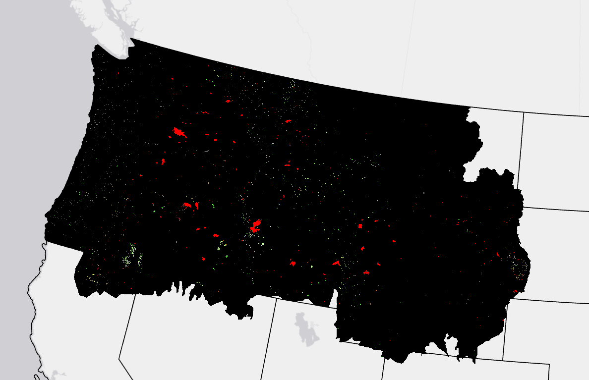
LANDFIRE (LF) Annual Disturbance (Dist) products depict where change occurred on the landscape, both spatially and temporally, on an annual basis. These products inform model vegetation transitions to provide updates to LF vegetation, fuel, and fire regime products.
Annual Disturbance products are attributed with disturbance year, type, and severity. These products are applicable in several areas of research and management such as landscape change, habitat gain/loss, carbon stock change, vegetation restoration, and more.
LF 2016 Remap and beyond includes a 90-kilometer buffer along the 1,500 miles of the eastern and southern borders AK shares with Canada. Then with the LF 2020 update, and future updates, for the Conterminous United States (CONUS) a 90-kilometer buffer into Mexico is also included.
Annual Disturbance Products
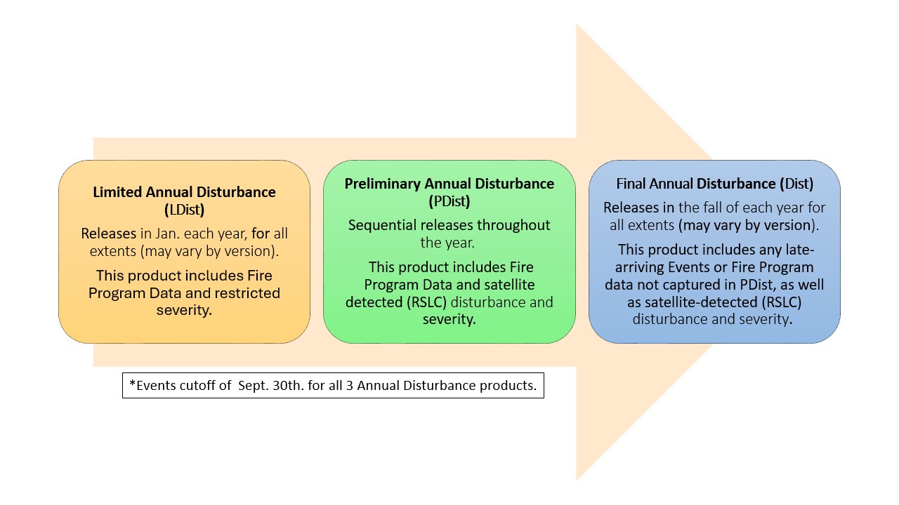
Limited Annual Disturbance
Limited Annual Disturbance (LDist) made its debut with the LF 2023 Update. LDist is designed to provide a first cut of landscape change information as soon as possible to support time-sensitive updates such as risk management efforts. This early release does not include satellite change detection to capture additional disturbances and does not provide image-based severity for contributed events. Some fire program data includes severity which is present in the LANDFIRE LDist product. However, many fires and disturbance events lack severity assignments, therefore LDist severity is a default based on disturbance type (Clearcut = High Severity, Wildfire = Medium Severity, all others including prescribed fire = Low Severity).
LDist includes data inputs from the following sources:
- Fire program perimeters and burn severity where available from four sources: Monitoring Trends in Burn Severity (MTBS), Burned Area Reflectance Classification (BARC), Rapid Assessment of Vegetation Condition after Wildfire (RAVG), Landsat Burned Area (BA)
- Event polygon datasets submitted from two national contributors: US Bureau of Land Management (BLM) and the National Park Service (NPS)
- Event polygon datasets obtained from these online national sources: Forest Service Activity Tracking System (FACTS), National Fire Plan Operations and Reporting System (NFPORS), National Interagency Fire Center (NIFC), USFS National Insect and Disease Risk Map (NIDRM), and Interior Fuels and Post-fire Reporting System (IFPRS)
The LDist product, first featured in the LF 2023 update, is an early "draft" of the LANDFIRE Annual Disturbance product and includes fires, disturbance events, and land management activities for the previous Fiscal Year from trusted national sources obtained in November of the previous calendar year.
Preliminary Annual Disturbance
Preliminary Annual Disturbance (PDist) is another new product making its debut with the LF 2023 Update. PDist is designed to provide a second "draft" of landscape change information and will have multiple extent releases throughout each year:
- Conterminous United States (CONUS) – by GeoArea
- Alaska (AK)
- Hawaii (HI)
- Puerto Rico and the U.S. Virgin Islands (PRVI)
PDist includes disturbance events for the previous Fiscal Year from regional sources obtained in November of the previous calendar year. Additionally, similar to annual disturbance products in past versions, PDist includes results from LANDFIRE satellite change detection and image-based severity. A complete list of data contributors can be found here: LANDFIRE Program: Contribute Data - Previous Contributions.
The PDist product featured in the current version will be used to update the Vegetation and Fuel (including Fuel Disturbance) products included in releases throughout the rest of the year.
Annual Disturbance
The Final Annual Disturbance (Dist) product is the "final" draft of Annual Disturbance data for a given version. Compared to PDist, Dist includes additional fires and disturbance events for the previous Fiscal Year, these events were harvested from a second "pull" of the national online sources in the summer of the current calendar year.
- The Public Events Geodatabase for the current version is always released in the fall, and includes events captured from this second "pull".
- The events harvested from the second "pull" will not be incorporated into the production of Fuel Disturbance (FDist) and other Fuel, Vegetation, and Fire Regime products. These events will be included in the next version.
Annual Disturbance Resources
CONUS Limited Disturbance (LDist) All Years
Alaska Limited Disturbance (LDist) All Years
Hawaii Limited Disturbance (LDist) All Years
IA/Puerto Rico/Virgin Islands Limited Disturbance (LDist) All Years
CONUS Preliminary Disturbance (PDist) All Years
Alaska Preliminary Disturbance (PDist) All Years
Hawaii Preliminary Disturbance (PDist) All Years
IA/Puerto Rico/Virgin Islands Preliminary Disturbance (PDist) All Years
CONUS Disturbance All Years
Alaska Disturbance All Years
Hawaii Disturbance All Years
IA/Puerto Rico/Virgin Islands Disturbance All Years
Addressing Hurricane Helene's Disturbance: A Customized Mapping and Data Integration Solution
LANDFIRE's NEW Disturbance Products (and Severity Data) Explained
A day in the life of a LANDFIRE Disturbance Mapper
The Spatially Adaptable Filter for Error Reduction (SAFER) Process: Remote Sensing-Based LANDFIRE Disturbance Mapping Updates
Methods used to mitigate data gaps in LF 2012 and beyond.
A LANDFIRE Disturbance explained
Annual Nationwide Remote Sensing of Disturbance for LANDFIRE (2021)
Mapping Disturbance for the Conterminous United States in Less than Six Months: Exploring Improvements in Processing Power, Image Compositing, and Improved Change Detection Algorithms
Keeping LANDFIRE Data Current – It's a Matter of Disturbance
Monitoring Trends in Burn Severity