Pictures of what the LF program incorporates with the LANDFIRE logo on the left and USFS and DOI on the right
LANDFIRE - multi-partner wildland fire, ecosystem, and wildland fuel mapping project USFS DOI
[Skip to Content]
  Button for Who Are We
 
 
Homepage » Data Products Overview » Data Product Quality » National Assessment » Great Basin Super Zone

Great Basin Super Zone Results


Data Products:Reference  ∕  Disturbance  ∕  Vegetation  ∕  Fuel  ∕  Fire Regime  ∕  Topographic  ∕  Who are We
     Notifications Alerts

Latest NewsLatest News

Get Data

Great Basin Super Zone LANDFIRE Mapping Zone 13 LANDFIRE Mapping Zone 16 LANDFIRE Mapping Zone 17 LANDFIRE Mapping Zone 12 LANDFIRE Mapping Zone 18

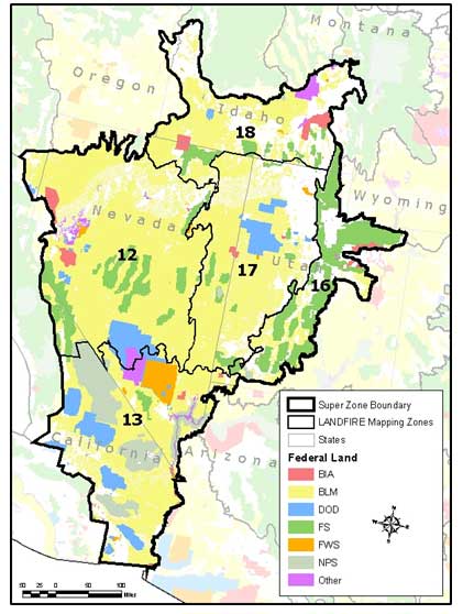
Download contingency tables for this Super Zone.

Click in the map to download contingency tables for a specific LANDFIRE (LF) mapping zone.

Note: The PQWT strongly cautions users against using individual map zone results because of sample size and sample distribution issues which severely limit the inferences that can be reliably made from them. They are made available here to provide full disclosure of agreement assessment results, but the PQWT recommends the Super Zone results for most users.


Users may experience intermittent service Thursday evenings due to routine maintenance.
The LF Map Viewer (DDS) will be down every 3rd Wednesday from 8 am - 10:00 am (CDT) for routine maintenance.
URL: https://www.landfire.gov/
To view and print a PDF you must obtain and install the Acrobat® Reader, available at no charge from Adobe Systems.
*DOI and USGS link and privacy policies apply.
Looking for something: Site Map   /   Search
Page Contact Information: LF Helpdesk