


 Latest News
LANDFIRE (LF) focuses on producing and delivering quality products and has mechanisms in place to allow for assessments and feedback on product quality. The following incorporates LF 1.0.0 (National) product quality evaluation:
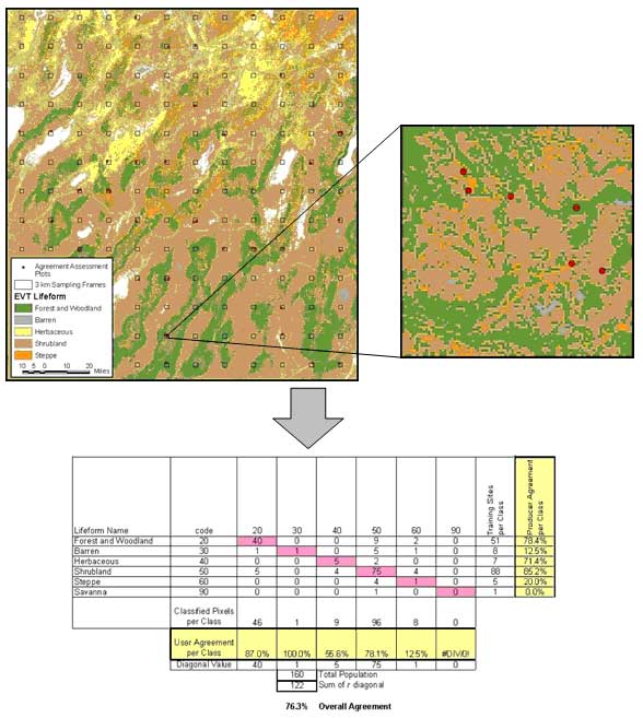
Example of the sampling design used to withhold field plots for product quality assessment and a resultant contingency table displaying assessment results.
View the larger image.


